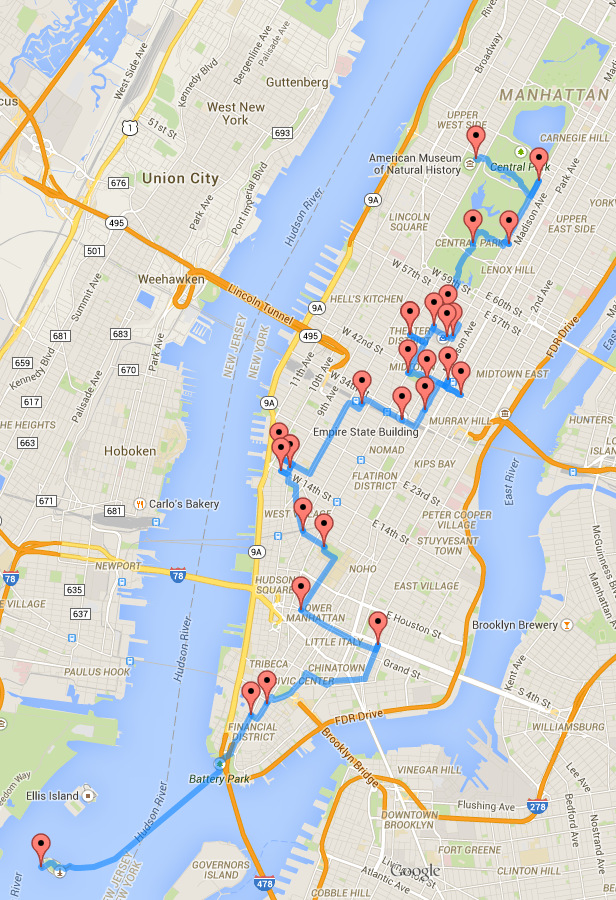
If you follow travel blogs, you have probably seen posts on the optimal road trips through the United States and Europe. The brilliant coder behind these maps is a PhD candidate named Randy Olson. Now he has used the same algorithm to create optimized walking tours of New York City and Philadelphia.
Olson used top TripAdvisor attractions to plan visits to major sites in both cities. If you plan to use either map, it might be a good idea to spread the tours over at least two days. And if you use the Philadelphia map, use public transportation, a bike or car to do the Fairmount Park and Zoo bit.
Before you go, visit Olson’s blog to find out more and to even use his algorithm to create your own walking tours.


Reblogged this on mariapapageorgiou30.