
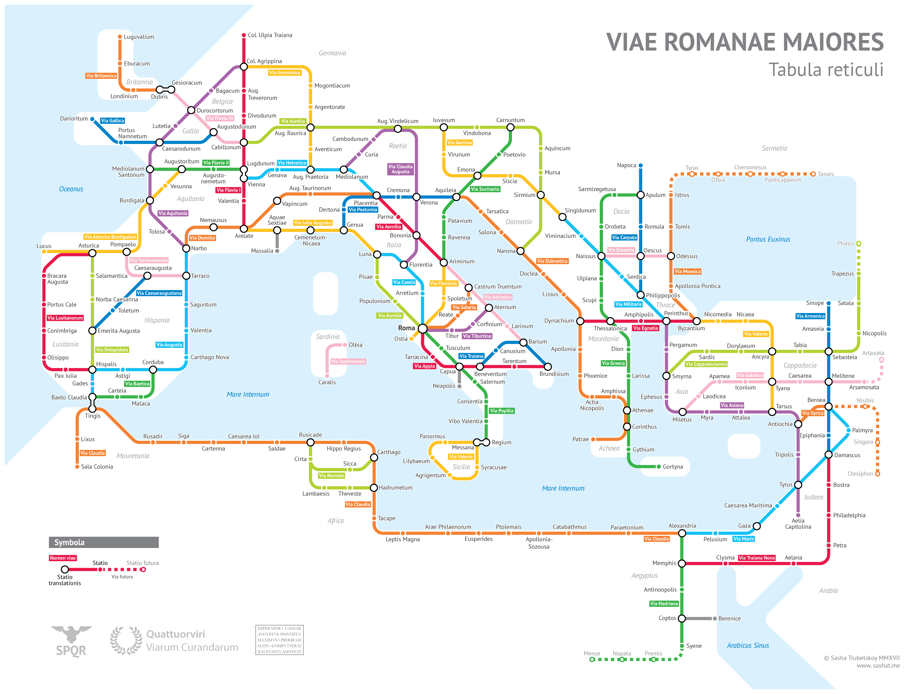
University of Chicago geography major Sasha Trubetskoy created this clever metro map-styled visualization of major Roman roads circa 125 AD. Although he admits to taking some liberties with road names, it’s a brilliant idea. You can learn more about his project on his blog.
h/t to Cameron Booth and Jools Stone

