Mapping the Past

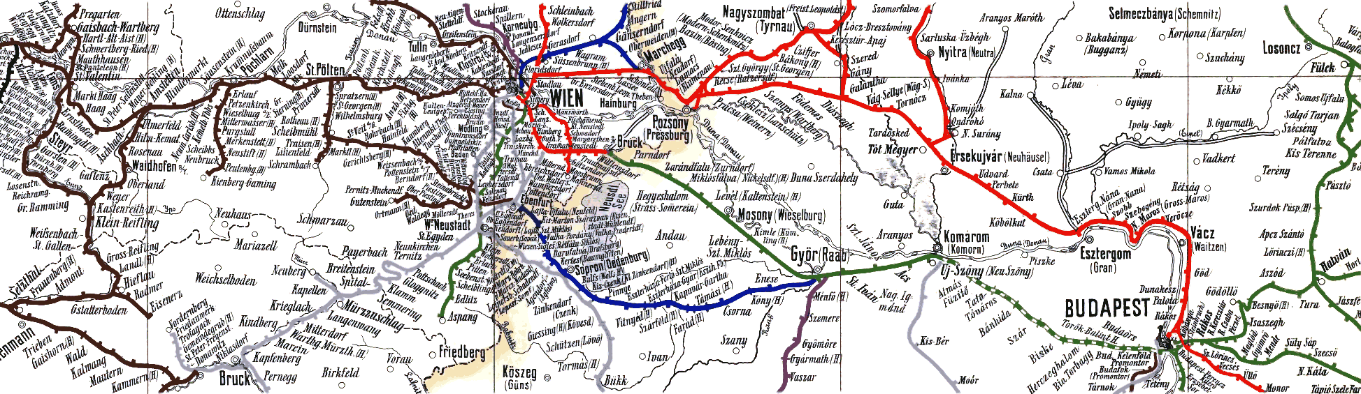
In one of my frequent sojourns down the rabbit-hole of the internet, I stumbled on these wonderful 19th century railway maps. The map above was created by Joseph Beers in 1884 to depict the railroads of the Austro-Hungarian Empire. His map cleverly used colors to differentiate between the railway companies.

The diagrammatic map below was published in 1890 in the French rail journal Revue Générale des Chemins de Fer. The unidentified cartographer proportionally positioned major cities connected by rail routes for the famous Wagon Lits lines.

This entry was posted in Europe, History, Maps, Public Transport and tagged , , , , , . Bookmark the permalink.

Leave a Reply

Fill in your details below or click an icon to log in:

WordPress.com Logo

You are commenting using your WordPress.com account. Log Out /  Change )

Twitter picture

You are commenting using your Twitter account. Log Out /  Change )

Facebook photo

You are commenting using your Facebook account. Log Out /  Change )

Connecting to %s

This site uses Akismet to reduce spam. Learn how your comment data is processed.