

I have long been intrigued by old school pictoral maps. The exmples above and below are from the University of Michigan’s Clark Library Maps collection, each shows the United States through a different cultural lens, covering everything from literary giants and music to national parks and transportation. Some were created as part of marketing campaigns, while others are simply educational.
The map at the top was “published in the interest of a better understanding and appreciation of the life and works of Mark Twain by Warner Bros. Pictures, producers of ‘The Adventures of Mark Twain.’” Published in 1944, it delivers on its promise, providing a wealth of information with both captioned photographs and illustrations.
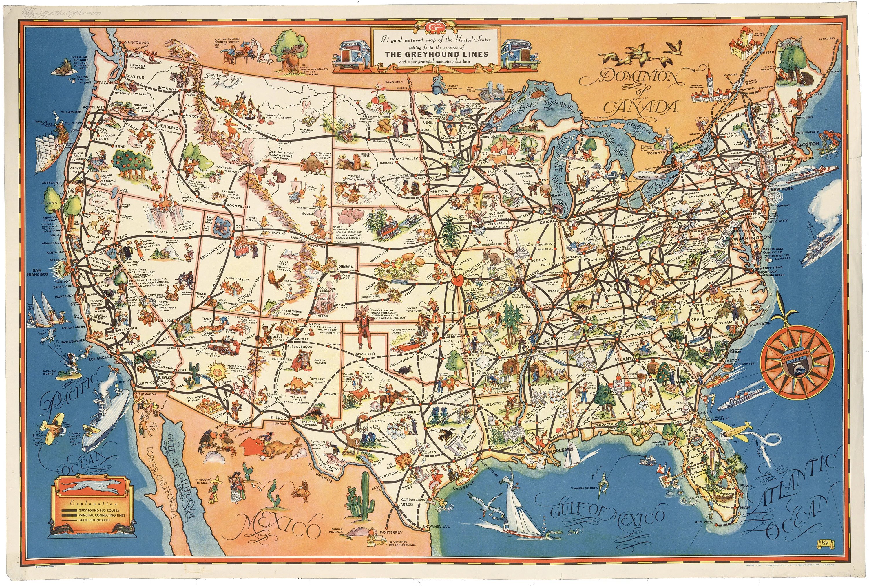
The primary purpose of this pictoral map was to promote Greyhound bus routes in 1934, the year it was published. The bus company still operates throughout the United States, but with a less comprehensive set of routes.
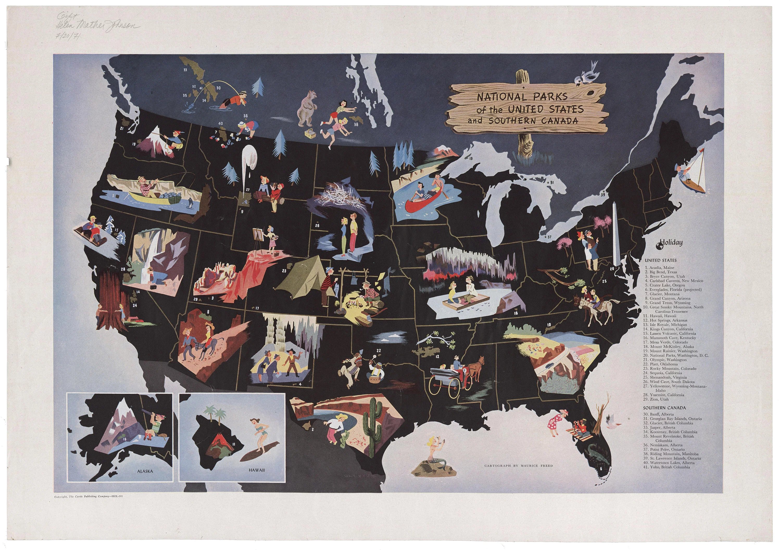
This map of National Parks of the United States and Southern Canada was created by Maurice Freed and published in the 1950s by the Curtis Publishing Company. The map itself is composed entirely of images with an index of numbered National Park names.
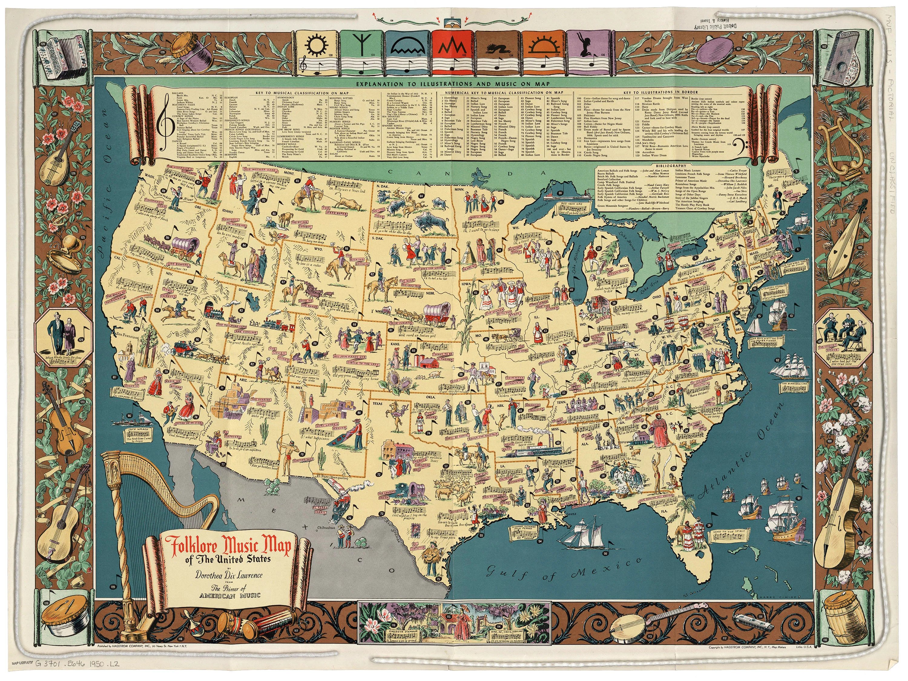
The Folklore Music Map of the United States above was created by Dorothea Dix Lawrence, who was a very successful opera singer turned folklorist, and includes illustrations with an index of descriptions. It was printed around 1950.
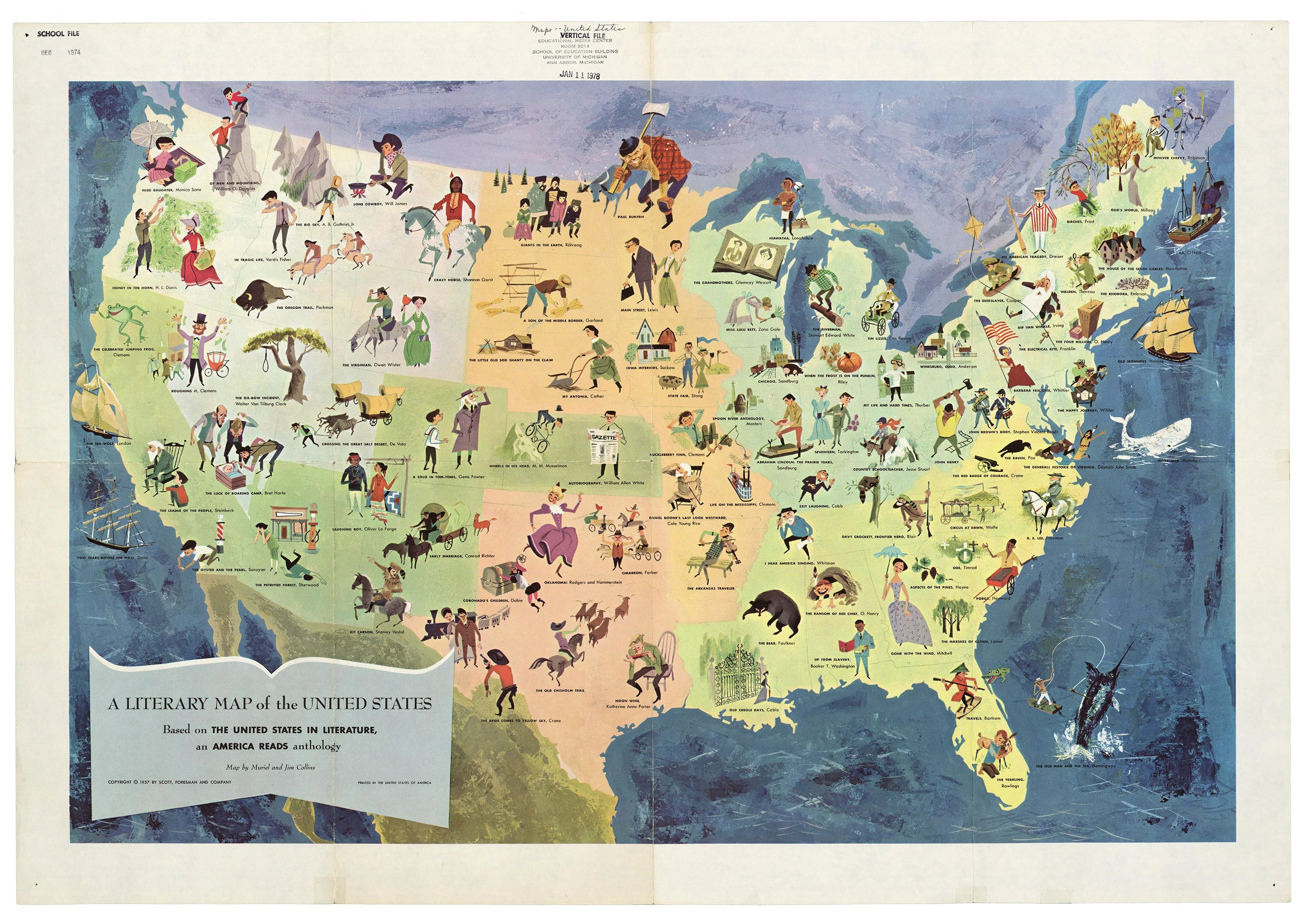
Published in 1957,this literary map is based on The United States in Literature, an America Reads anthology.

