
 🐱 Artful Cats: This collection of cat-inspired art and artifacts from across the Smithsonian is a truly delightful set to browse through. Paintings, sketches, ceramics, centuries of artists who just couldn’t resist drawing cats. You could easily lose an hour in here.

The smorgasbord: What began as modest, rule-bound dining in Sweden evolved into something akin to a “pagan feast” in the United States… more »
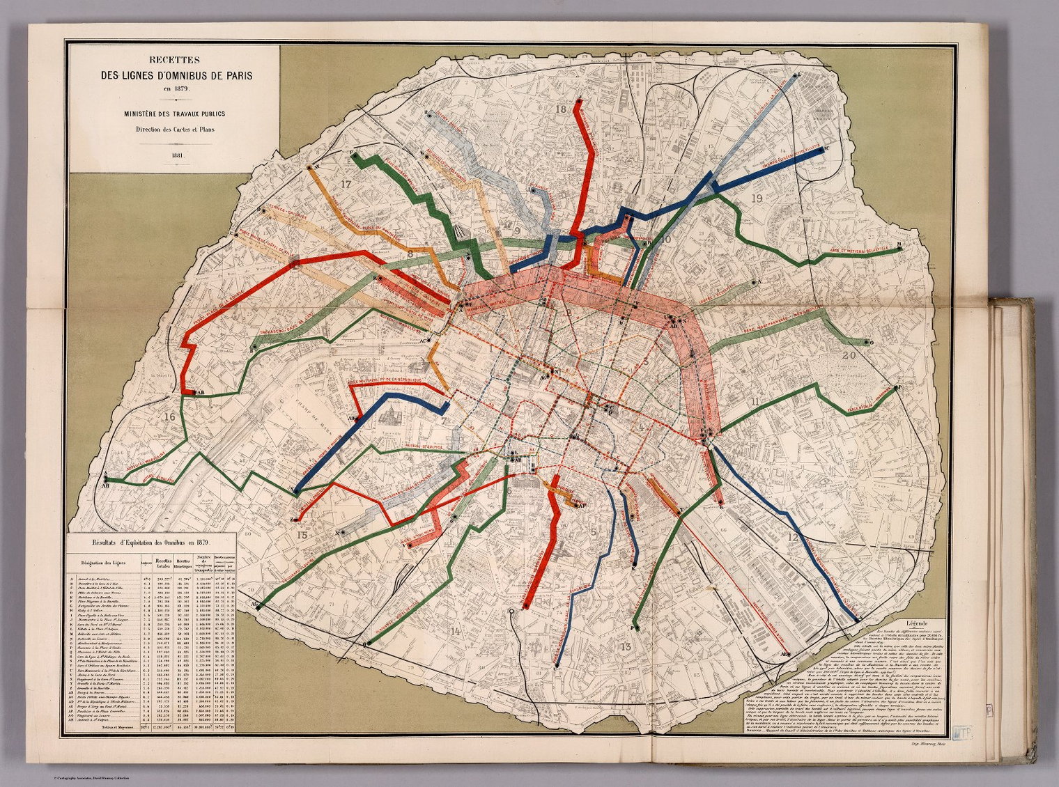
An exhibition at the David Rumsey Map Center at Stanford University, You Are Here: Transit Cartography and Spatial Identity, explores the evolving design language of transit maps and the relationship of that design language with the identity of the place being mapped.
You Are Here explores the unique relationship between regional and global transit maps and the socio-cultural identity of their subjects. Transit maps can be utilitarian, functioning as navigational tools, but they can also be aspirational, signs of cities and nations attempting to shift perceptions of their identity. The individual maps in this exhibition serve as a window into the histories of the places they represent as well as the history of transit cartography as a whole. With a wider view, the evolution of transit maps demonstrates how a transportation system can become synonymous with a city or nation’s identity, reflecting its change over time, spearheading cartographic innovations, or reifying an entirely new vision for space and place.
The exhibition is both in-person and online; it opened March 25 and runs until August 21, so if you’re in the area, hurry up; I imagine the online version will stay up, at least for a bit.
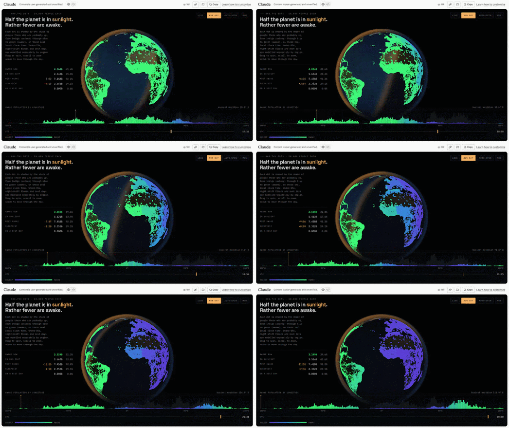
At the moment (as I write), 6.962 billion people are awake, while another 2.1 billion are fast asleep. Awake Globe visualizes this constantly shifting global rhythm of sleep and wakefulness, revealing where people around the world are currently awake, asleep, or somewhere in between.
The map presents the Earth as a glowing, rotating globe. Daylight sweeps across its surface at around 1,000 miles per hour (at the equator), while millions of tiny colored points show where people are currently awake or asleep. Blue represents people who are tucked up in bed, while green indicates those who are awake, with a spectrum of colours in between showing the gradual transition from sleep to wakefulness.
The actual sleeping and wide-awake populations shown on the map have been derived from a number of different sources using a modelled sleep window. Population data comes from GeoNames, covering 135,233 settlements and around 3.13 billion people. The remaining 4.97 billion people are estimated as rural populations, distributed across each country’s land according to local settlement density. The sleep model then estimates when these populations are likely to be awake or asleep, taking into account factors such as age, night-shift work, time zones and different working weeks.
Awake Globe is not meant to be a precise census of humanity’s sleeping habits. It is more of a modelled visualization of one of our planet’s daily rhythms. As day and night sweep around this virtual globe, the colors constantly change, revealing the shifting boundary between the billions of people who are awake and those who are sleeping.
via Maps Mania

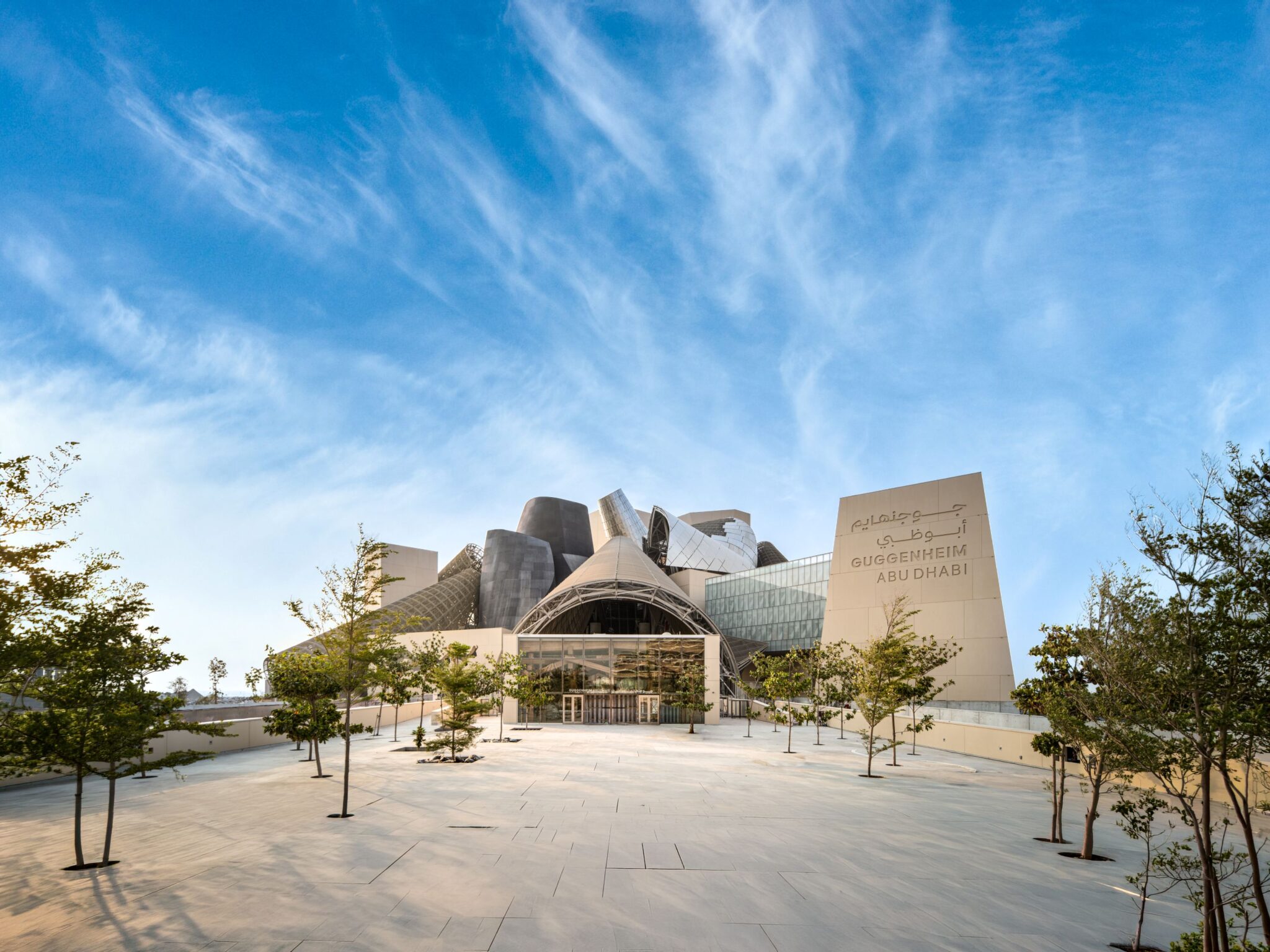
The Department of Culture and Tourism – Abu Dhabi has announced that Guggenheim Abu Dhabi (above) will open its doors on December 11, 2026. It was designed by the late Pritzker Architecture Prize Laureate Frank Gehry. It joins a growing community of museums and cultural institutions in Saadiyat Cultural District, including Louvre Abu Dhabi, Zayed National Museum, Natural History Museum Abu Dhabi, and teamLab Phenomena Abu Dhabi, positioning the district as one of the world’s most significant concentrations of cultural institutions. (Read More)


