

The simple creativity in the new video below for VisitOslo is rare in tourism ads these days, most of which blend into each other. This is different, a typical understated Norse dry sense of humor.
The simple creativity in the new video below for VisitOslo is rare in tourism ads these days, most of which blend into each other. This is different, a typical understated Norse dry sense of humor.

Regular visitors to Travel Between The Pages are aware that I am both a Sci-Fi and space exploration geek. So it will come as no surprise that I am sharing the marvelous short film below. Wanderers is made even better by its narration by the great philosopher/scientist Carl Sagan. Here’s what the filmmaker Erik Wernquist had to say about his project:
Wanderers is a vision of humanity’s expansion into the Solar System, based on scientific ideas and concepts of what our future in space might look like, if it ever happens. The locations depicted in the film are digital recreations of actual places in the Solar System, built from real photos and map data where available. Without any apparent story, other than what you may fill in by yourself, the idea of the film is primarily to show a glimpse of the fantastic and beautiful nature that surrounds us on our neighboring worlds – and above all, how it might appear to us if we were there. As some may notice I have borrowed ideas and concepts from science fiction authors such as Kim Stanley Robinson and Arthur C. Clarke, just to name a few. And visually, I of course owe many tips of my hat to painter Chesley Bonestell – the legendary master of space art. More directly, with kind permission from Ann Druyan I have also borrowed the voice of astronomer and author Carl Sagan to narrate the film. The audio I used are excerpts from his own reading of his book ‘Pale Blue Dot: A Vision of the Human Future in Space’ (1994, Random House, http://www.penguinrandomhouse.com/boo…) – needless to say, a huge inspiration for this film.

CLOSE is a very neat visualization project that shows where to locate in city neighborhoods essential amenities within a short distance of travel. “Proximity governs how we live, work, and socialize. Close is an interactive travel time map for people who want to be near the amenities that matter most to them.”
This can be a very handy tool for travelers who often have no clue how to access local sites when visiting a new city. Currently only focused on U.S. cities, but hopefully, the creators will be expanding to Europe and beyond really soon.


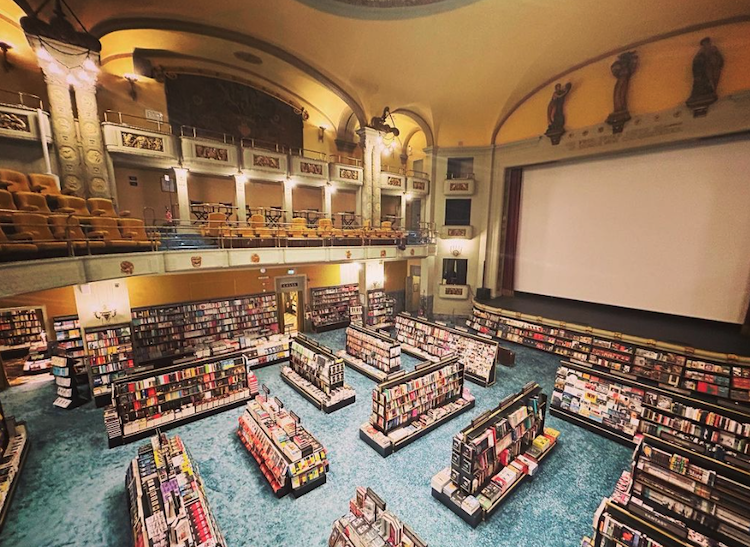
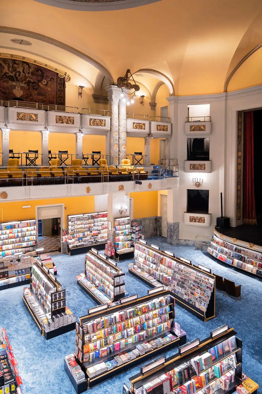
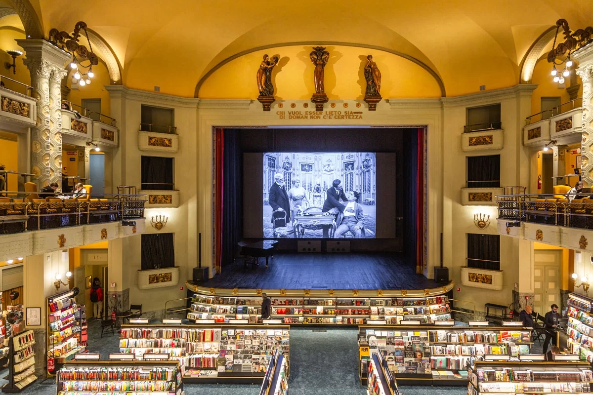
It’s been more than a decade since I’ve visited Florence, so you will have to forgive that I missed the grand opening to the amazing Libreria Giunti Odeon. This fabulous mash-up of a cinema, bookstore and cafe premiered in November 2023 after years of renovation. The restore 1922 Art Nouveau movie theater/bookshop is housed in the historic Palazzo dello Strozzino. Built around 1457, and designed by Filippo Brunelleschi, the palazzo was owned by the Strozzino family until the 19th century. In 1904, it was bought by the Chiari family who eventually decided to build an elegant cinema.
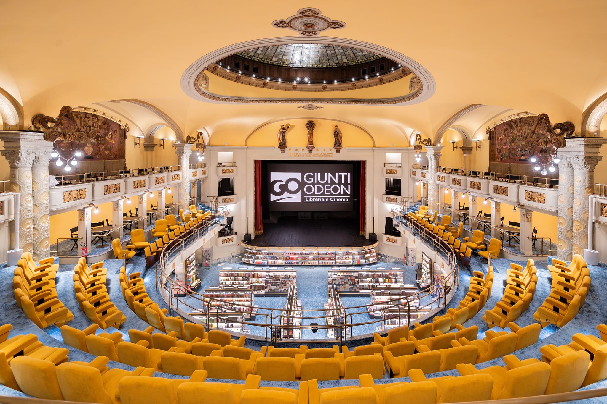
After alternating periods as theatre and then cinema, in 2023 the Odeon, which still retained splendid Art Nouveau style, was renovated and reopened as the Giunti Odeon. Bookshop and Cinema.
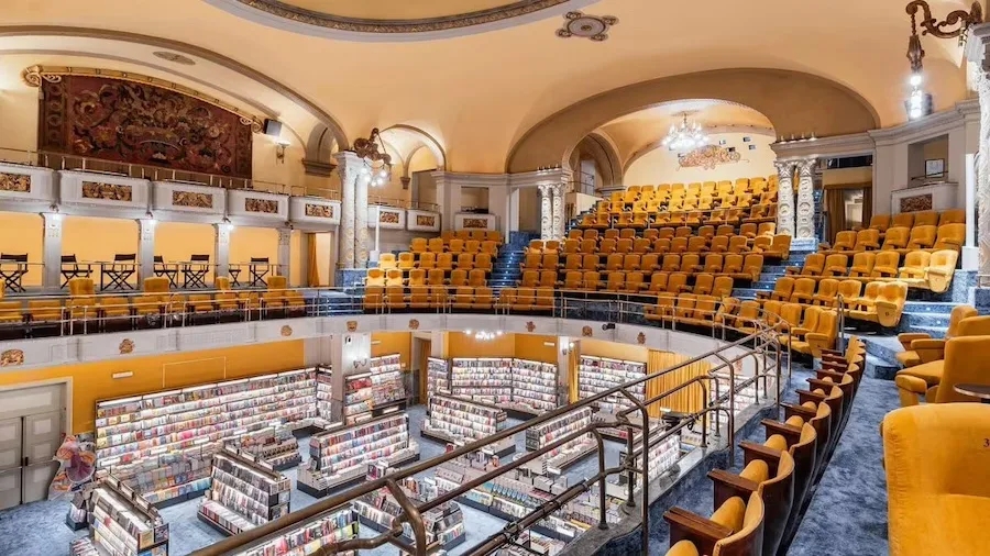
Open seven days a week, from 8.30 in the morning to the end of each night’s film, Giunti Odeon, or GO, as it is known to the locals, maintains its mission as a cinema. One screen guarantees nightly film screenings in their original languages, while a LED wall projects daytime entertainment in Italian and English. Throughout the theater are the bookshelves lined with 25,000-plus titles occupying the entire ground floor, including the foyer.
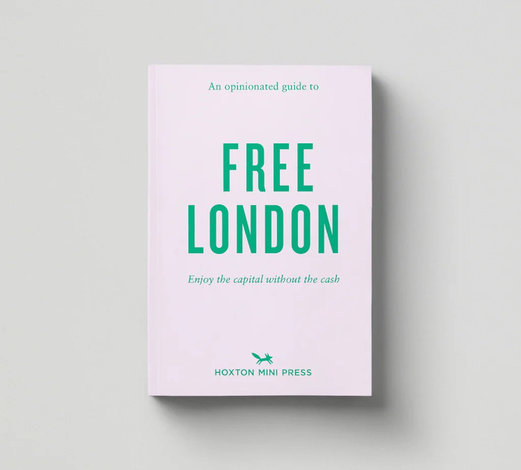
Some of the vintage oldtimers who have been following Travel Between The Pages for many eons may recall that during the last century I made a dubious living writing travel guidebooks and newsletters. One of my better selling books was titled London For Free. It was also my most plagiarized books. In fact, knock-off versions were published in more than one country that simply lifted the text word for word and republished with a different cover. Que sera sera.
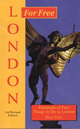
Any way, I am always on the look out for similar titles now that London For Free is long out of print. I recently ran across the guide Free London from Hoxton Mini Press of London and was happy to discover that they have issued a very extensive catalog of London travel guidebooks including the aforementioned title on no cost sites.

The range of titles is impressive and I will certainly pick up a few the next time that I visit London. Have any of you purchased or read books from the series ? What did you think ?


Happy Solstice to all. Stay chill . And please ditch the socks and sandals look.

57 Sandwiches That Define New York City. I challenge you to read this New York Times article all the way through and not crave one of these amazing sandwiches. NYC is home to ~23,000 restaurants, so choosing where to eat out can be a pretty overwhelming decision. Even if you narrow your culinary choices down to the humble sandwich, you could eat at a new restaurant for years in NYC without repeating yourself.

Growing up in and around the city I never stopped to appreciate the amazing range of food options available. Still, in my day the choices were much less elaborate than in the 21st century New York. Buon appetito !

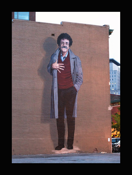
Kurt Vonnegut’s eight rules of writing:

I am continually amazed by the seemingly endless variations and spinoffs of Lewis Carroll’s classic Alice in Wonderland. But even I was surprised to discover that beginning in the 1930s, Guinness beer began using Alice in Wonderland and the cast of characters from Carroll’s books in their advertising. These campaigns continued until 1959, and in addition to many ads, Guinness also published five booklets, beginning with “The Guinness Alice” in 1933, and ending with “Alice Versary: The Guinness Birthday Book,” which was published to coincide with the brewer’s 200th anniversary in 1959. All of the booklets and advertising were created by their advertising agency, S.H. Benson Ltd., with illustrations by John Gilroy and later Ronald Ferns.


It’s surprising to learn that London wasn’t well mapped until the 1500s, but the cartographers, topographers, and historians of the Historical Towns Trust have the decided to remedy the problem by looking back in time to create period maps.. Their detailed atlases of 13th-century and Tudor London drill down to individual dwellings, parish boundaries and walls.


The team have put together two exceptionally detailed maps of the capital. The first, Tudor London, zooms in on the year 1520, showing the city shortly before the Reformation swept away the religious houses. The second map goes back as far as the late 13th century, more than 250 years before the dawn of London cartography.
“It’s about the earliest date we can really map the city in detail,” explains Professor Vanessa Harding, who contributed to the research and is the Chair of HTT. “From the mid-13th century we have a proliferation of written sources for houses, streets and landmarks; all the parish churches were in place, and most of the religious houses, though the guilds had yet to make their mark physically.”
You can buy paper maps here—also those of various other places including Oxford and Canterbury—or explore the digital ones online (e.g. medieval London, Tudor London, but there are all sorts of overlays to view).


