I have been a fan of Terry Pratchett’s Discworld series for decades. Although the books don’t get the attention they deserve in the U.S., the fan base is growing. Maybe the rise of the wacky “flat earth” movement will create more interest in the fantasy series.

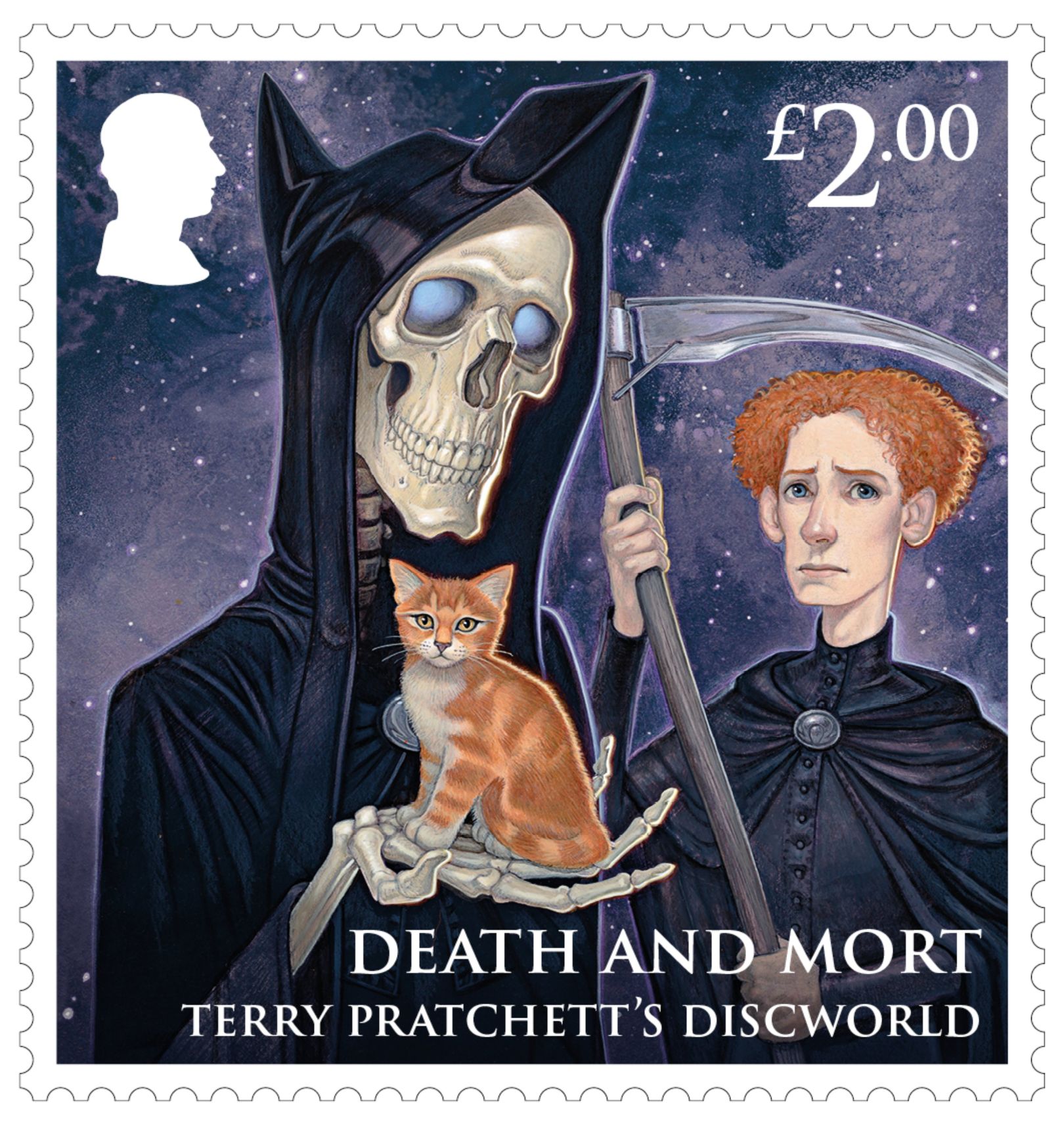
Last week, a new Royal Mail stamp collection that celebrates Terry Pratchett’s fantasy Discworld series, and the 40th anniverary of its first book, The Colour of Magic was released. The eight special stamps feature some of Discworld’s favorite characters including Rincewind, The Librarian, Granny Weatherwax, Sam Vimes, and Great A’Tuin, as well as specially commissioned artworks of Death and Mort, Tiffany Aching and Moist von Lipwig – all created by Terry Pratchet’s illustrator of choice, Paul Kidby.
Pratchett has long been regarded as one of the UK’s greatest fantasy writers. His Discworld series encompasses 41 novels that have been translated into over 40 languages, with more than a hundred million copies sold worldwide. If you’re not familiar with Discworld, it’s a flat, circular planet revolving on the shoulders of four giant elephants who stand atop a vast star turtle called the Great A’Tuin. This turtle is 10,000 miles long and of the species Chelys galactica. Its shell is scarred with meteor craters, and its eyes are as big as seas.
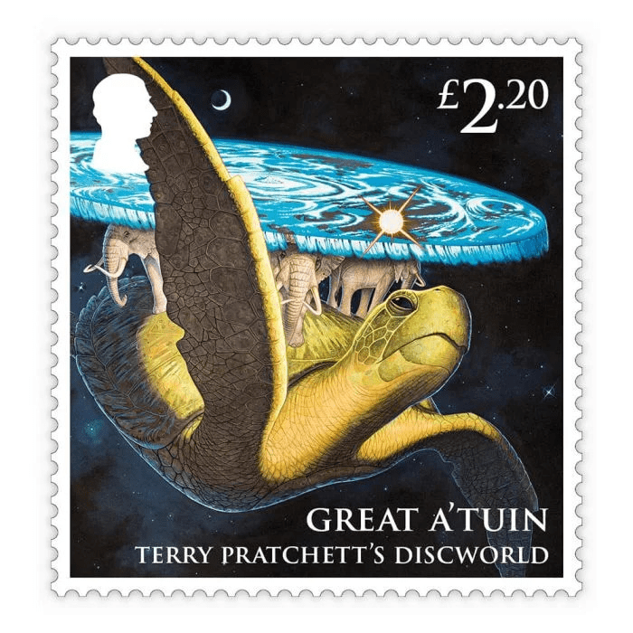
Illustrator Paul Kidby is behind the Royal Mail stamp collection that celebrates Terry Pratchett’s Discworld series.