During the past few months, I’ve taken more than a dozen city-specific transportation apps for a spin in half a dozen major metropolitan areas. Invariably I’ve been disappointed by flashy apps that failed to deliver. Sometimes the interface was just plain confusing. In other cases the information was not current or even totally inaccurate.
![]()
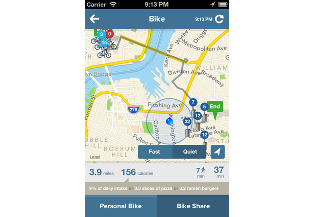
So, I was pleasantly surprised when I tried out the new Citymapper app for New York City this week. The app, created by the same team that produced the popular London Citymapper, is comprehensive, easy to use and spot-on accurate. The app integrates real-time data across all of NYC’s various transport options, including bus, subway, bike and pedestrian. It provides timely alerts on transit disruptions. It even provides the user with estimates of calories burned for each travel choice.
![]()
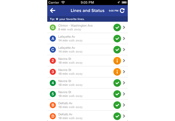

The success of Citymapper stems not from arcane algorithms but from brilliant unification of data from the MTA, Google Maps, Apple Maps, OpenStreetMaps and Forecast.io. The integrated real-time data results in a treasure of transportation information at your fingertips instantaneously. And best of all, it’s free.