
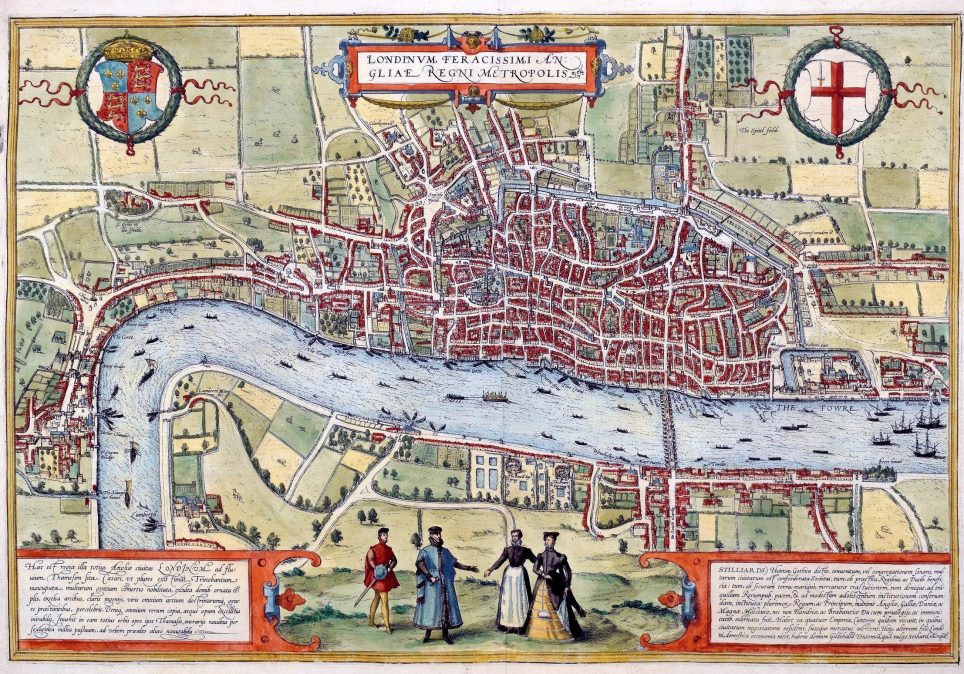
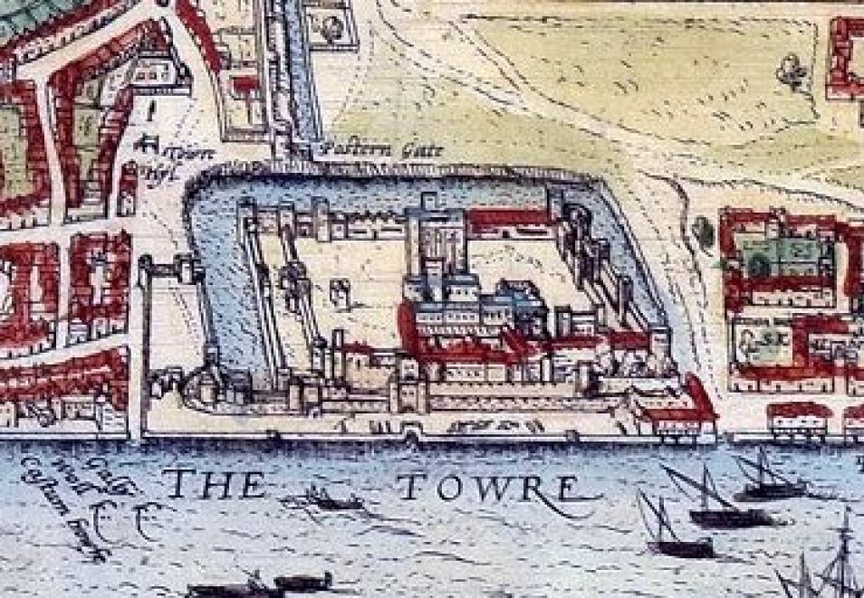
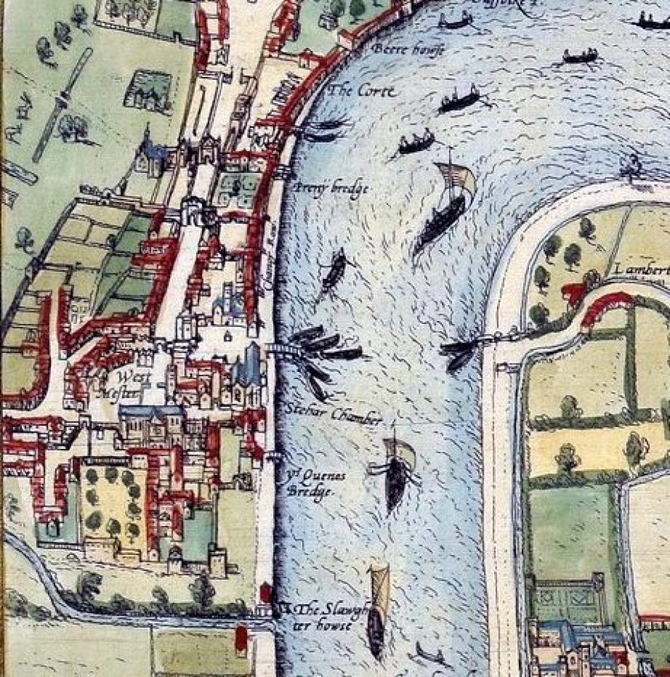
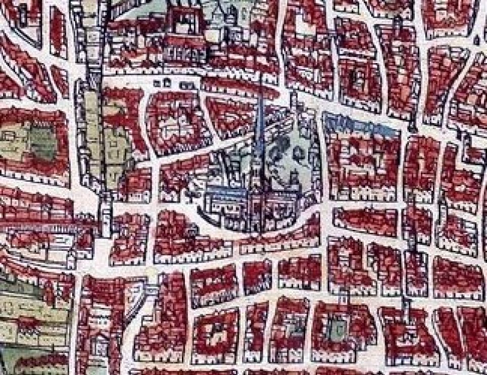
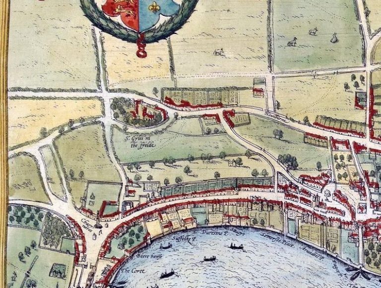
This recently discovered map of London from 1572 was created by the engraver Frans Hogenburg. Commissioned by the free-wheeling capitalists of the Hanseatic League,it provides a fascinating aerial view of the rapidly growing capital city. It shows that there was a large settlement north of the River Thames, but south of it was sparsely populated. The colorful map depicts many boats weaving their way down the river, which could only be crossed by the solitary Old London Bridge. Recognizable landmarks include the Tower of London, the Charterhouse Monastery and the old St Paul’s Cathedral, while Westminster is marked as ‘West Mester’. In a nod to a bygone age, bear baiting is shown in Southwark, and there are drawings of Queen Elizabeth figures around the map’s edges. The map is a rare example of an early printed map of London.


Fabulous map. I will share it with my son in London. I grew up there.