
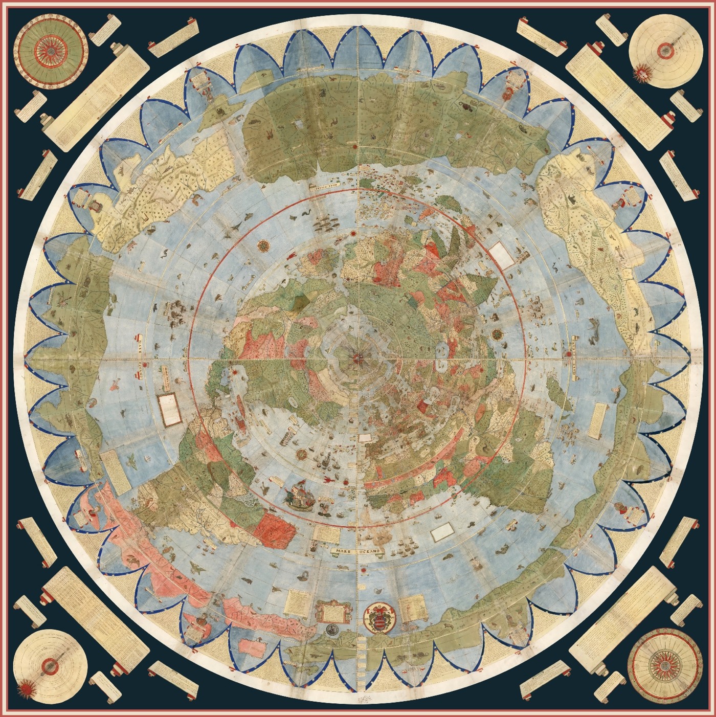
In 1587, Italian cartographer Urbano Monte created the largest known map of Earth. His map consists of 60 panels that were designed to be assembled into a single planisphere —a circular map that rotates about a central axis— measuring 10 feet across. The David Rumsey Map Center at Stanford University recently acquired a manuscript of Monte’s map and digitally assembled all 60 pieces into the full map .
Of great interest is the attempt Monte makes to make his map not just a geographical tool but to show climate, customs, length of day, distances within regions — in other words, to create a universal scientific planisphere. In his dedication on tavola XL he specifies how to arrange the sheets of the mappamondo and makes it explicit that the whole map was to be stuck on a wooden panel 5 and a half brachia square (3.25m) so that it could be revolved around a central pivot or pin through the north pole.
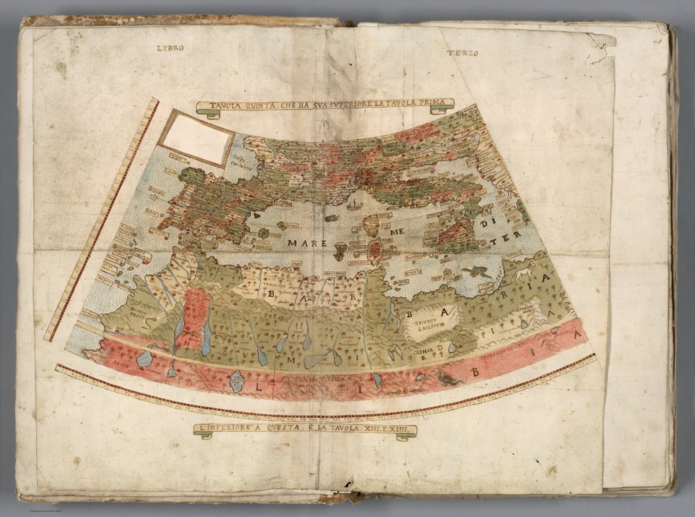
This is an example of an individual map panel :
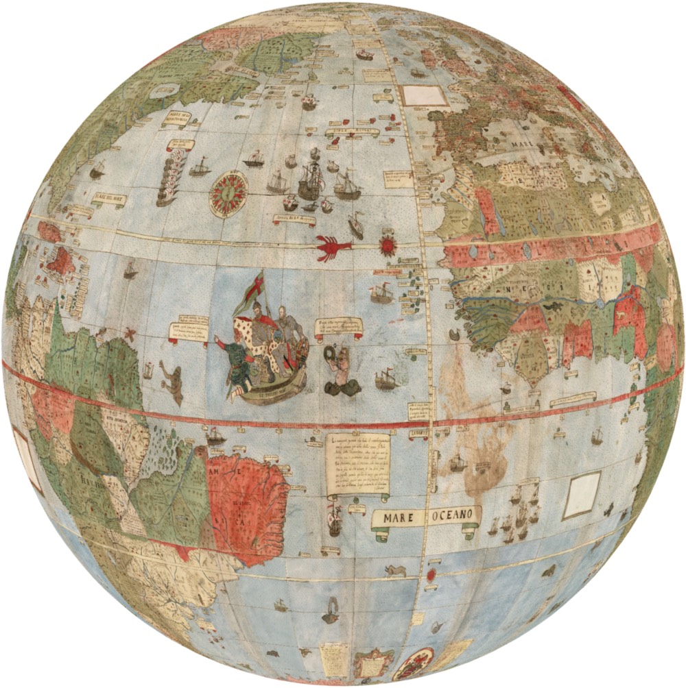
The image below is a rotatable globe version of Monte’s map created by Jeremy Ashkenas.


It seems incredibly accurate. Well, maybe Britain looks a bit peculiar, despite being better known than the Americas at the time.
I have been following your blog and enjoying it. We have a similar interest in maps, but my blog, which is focused on Rome and Italy (but not exclusively) has not yet revealed fully that interest. Keep up the good work.
Thank you for following TBTP. I look forward to checking out your blog. I have been to Italy many times and have fond memories, as well as stories of tourist blunders too.