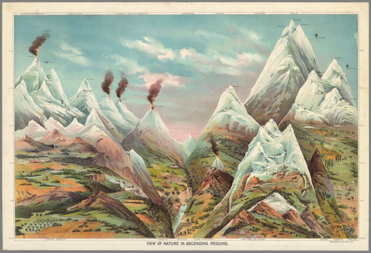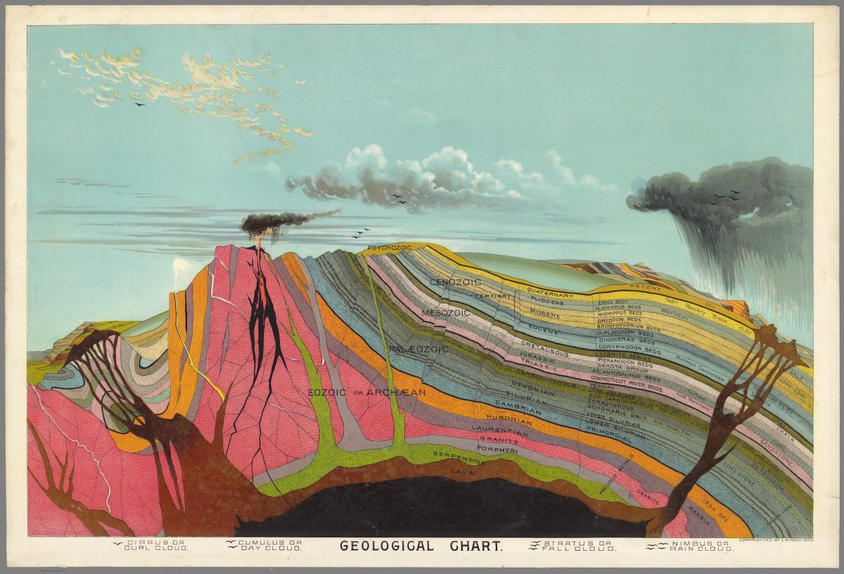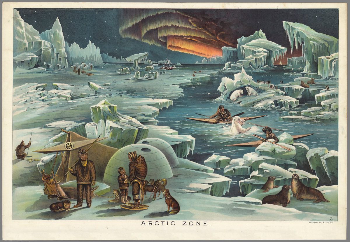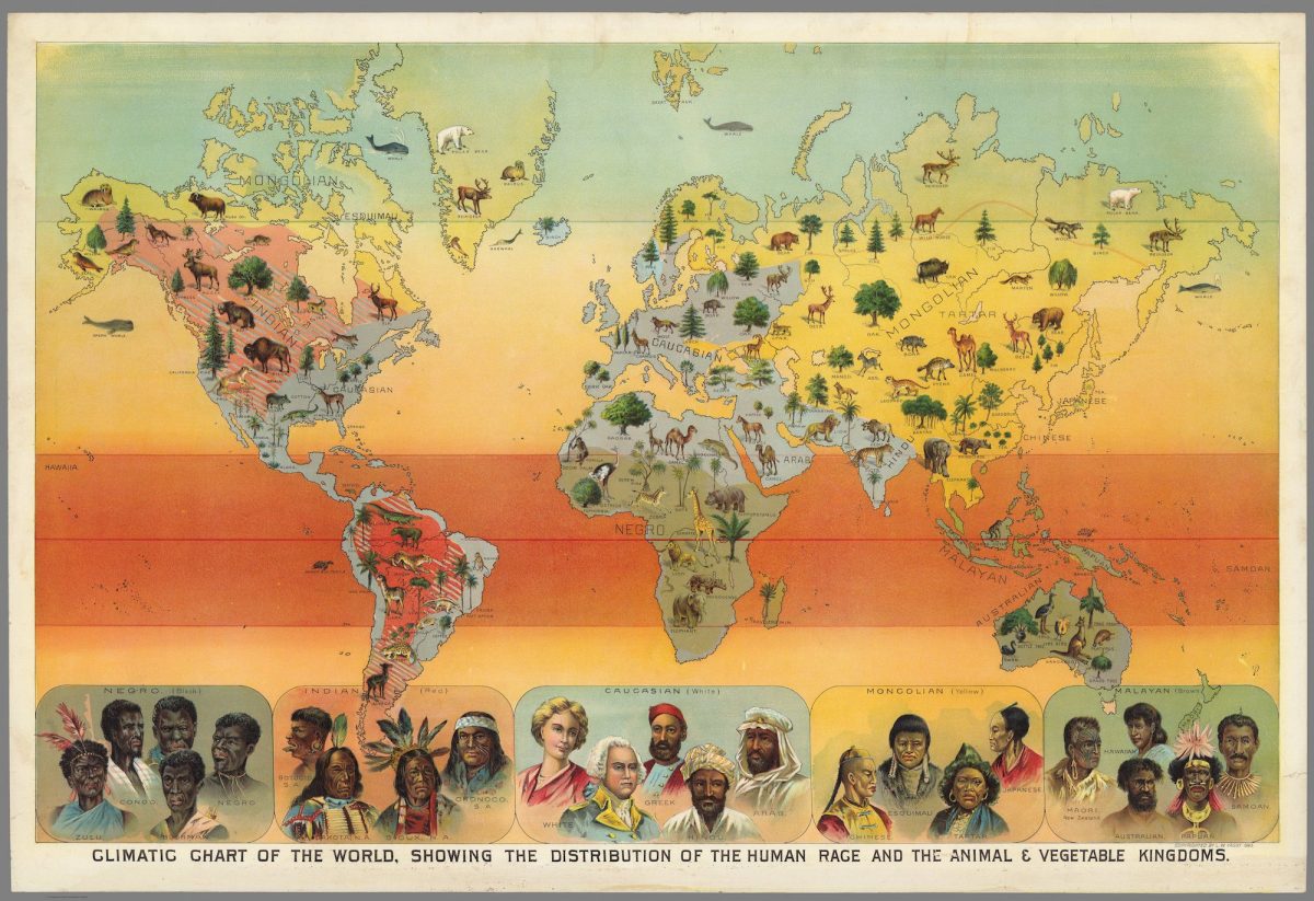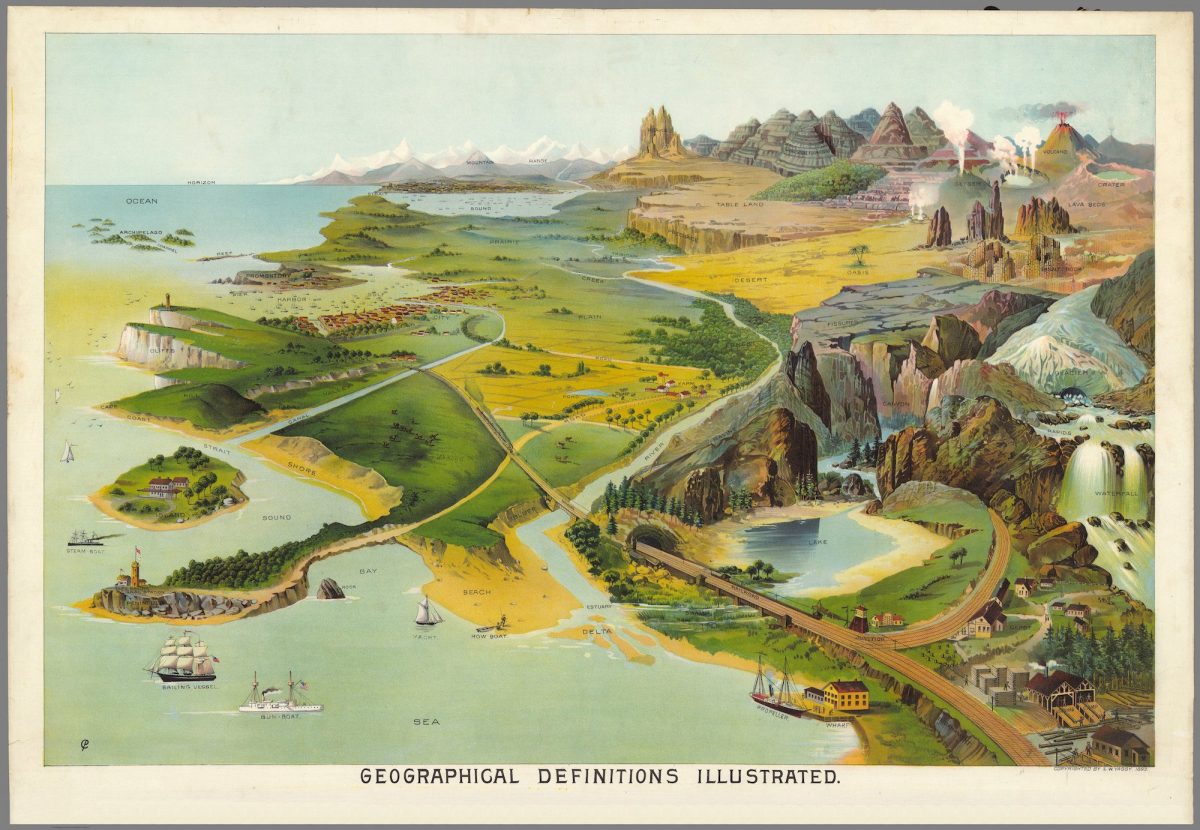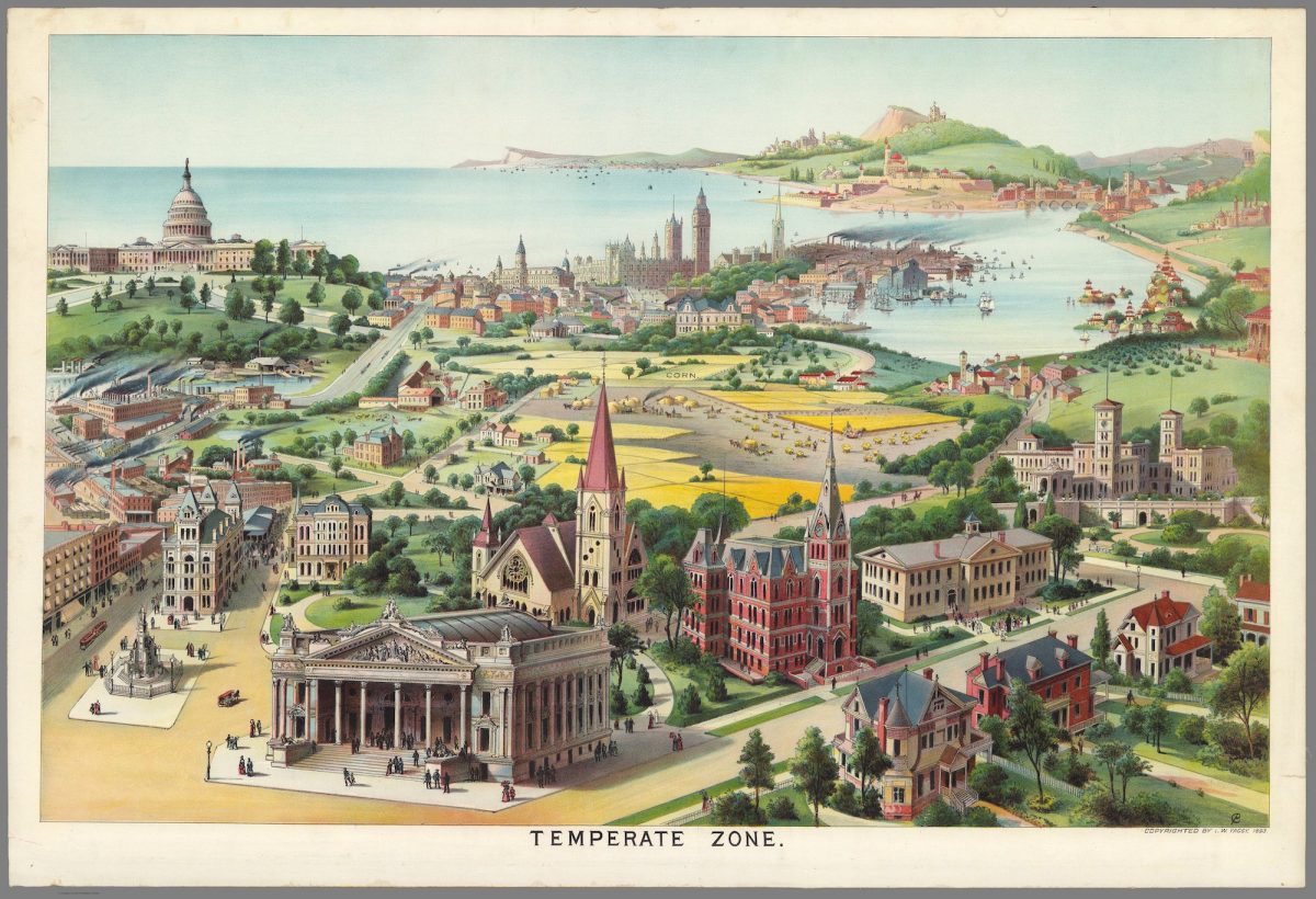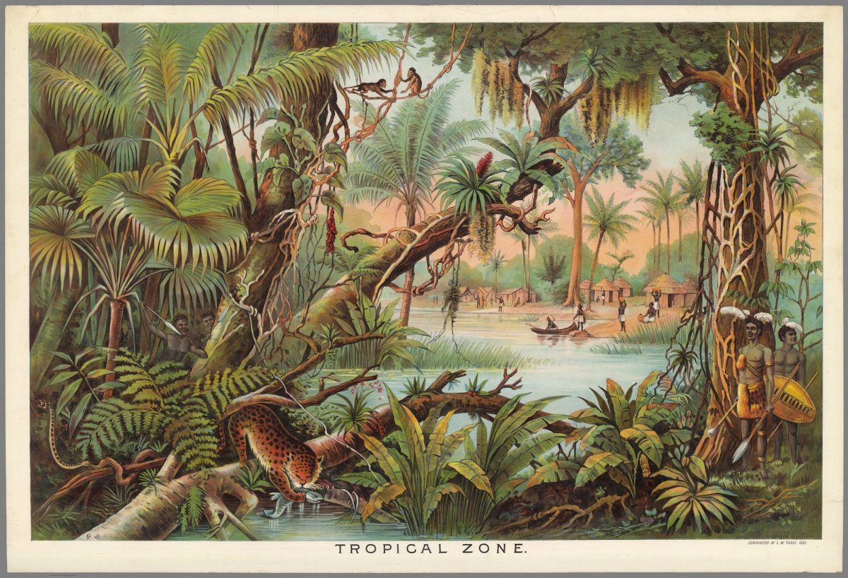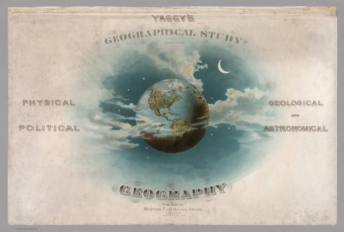
These illustrations are from Levi Walter Yaggy’s Geograpahical Portfolio – Comprising Physical, Political, Geological, and Astronomical Geography. Published by Western Publishing House of Chicago in 1887, the book features large educational geographical charts.
Using chromolithography, Yaggy created stunning colors and contrasts in his images of the world, its regions, and peoples. Yaggy intended his charts to be used in classrooms by students, and issued a teacher’s handbook to assist with instruction.
H/t to the David Rumsey Map Center at the Stamford University Library