

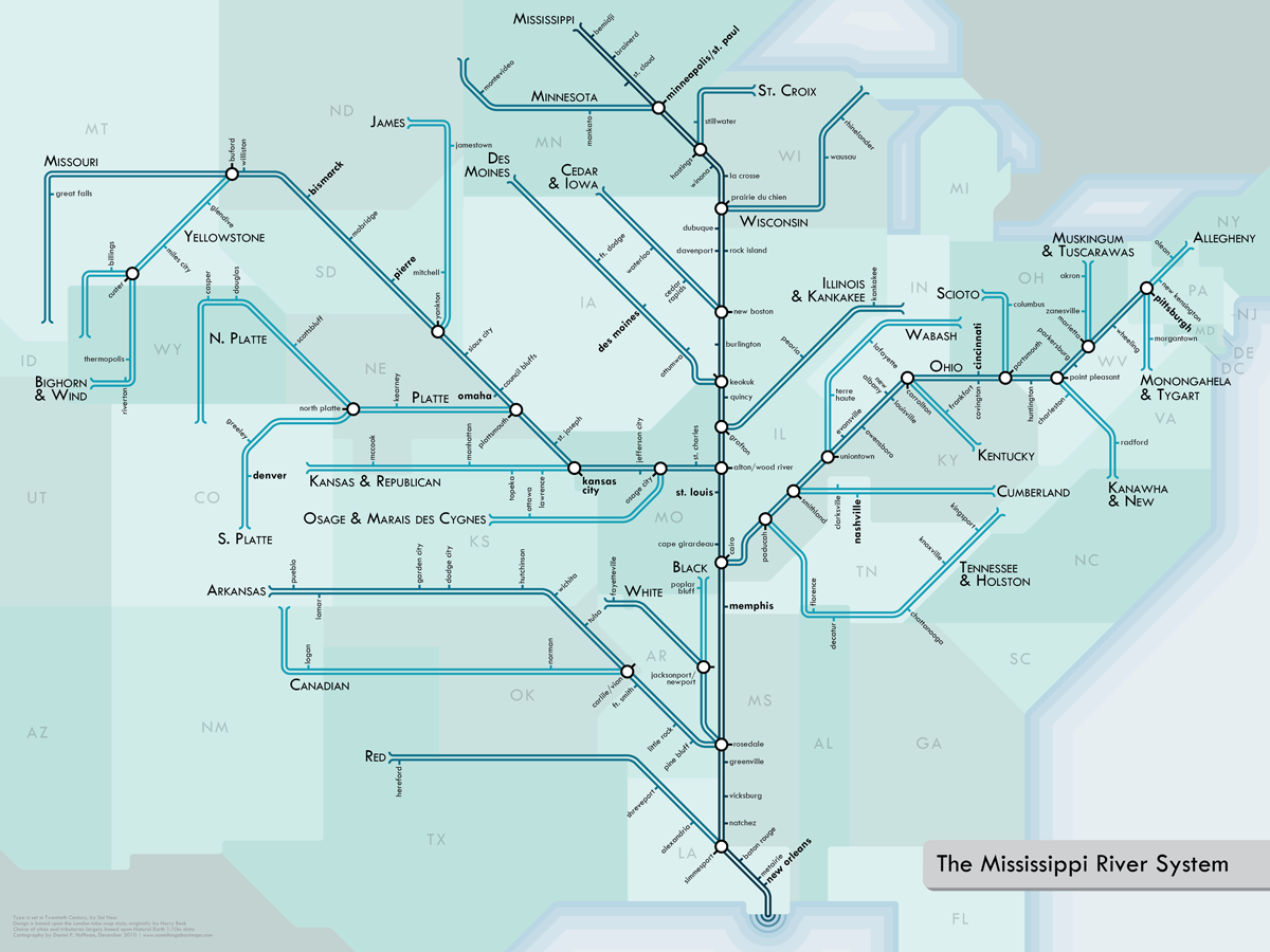
By now you all know that I love a clever map. And, there’s nothing better than a brilliant series of maps with a transit map theme. The map above is a terrific reimagining of North American rivers as a classic Tube style map. From the author:
This series of river maps is done up in a style inspired by urban transit maps such as those pioneered by Harry Beck in the 1930s for the London Underground. Straight lines, 45-degree angles, simple geometry. The result is more of an abstract network representation than you would find on most maps, and it’s not meant to be taken too seriously — I would not recommend actually transiting through these rivers, as many portions of them are not navigable. But they do, nonetheless, connect us.
If you’d like to know a bit more about how the maps were made, including the many many semi-arbitrary decisions that go in to them, click here.


Very interesting