
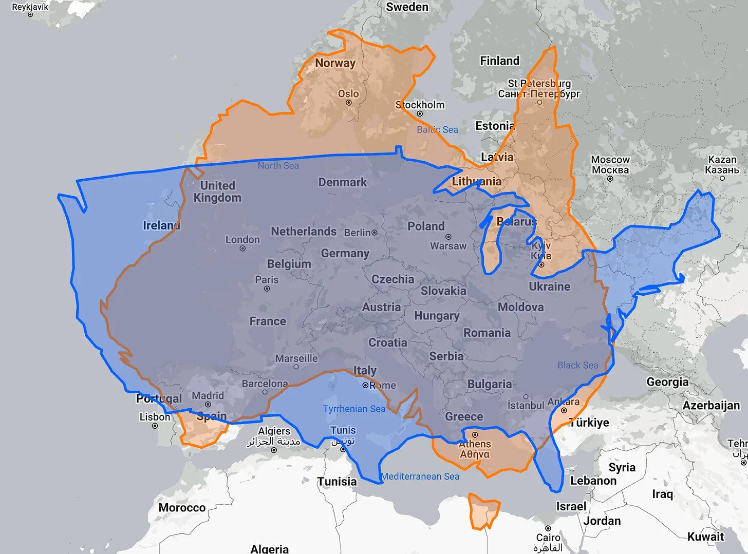
Most reasonably educated adults—other than flatearth nincompoops—are well aware that the way we map our planet distorts the actual size of countries and continents. For centuries, we have generally ignored the wildly misleading maps that are used in most publications. I recently stumbled upon an enlightening article titled “Maps Distort How We See the World” by Tomas Pueyo. His collection of maps and graphics offers a sobering examination of the ways in which we misunderstand our planet and the imapcts on policies and politics that result.

Brazil is the most short-changed country, as it’s right on the equator and huge. Here it is compared to Europe.


The Panama Canal runs north-south, and ships enter in the west and leave in the east


fascinating. along these same lines, France fits into Texas!